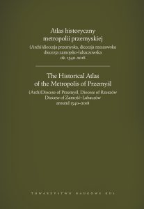
Wydanie i zamieszczenie w Internecie monografii: Atlas historyczny metropolii przemyskiej ok. 1340-2018 – zadanie finansowane w ramach umowy 591/P-DUN/2019 ze środków Ministra Nauki i Szkolnictwa Wyższego przeznaczonych na działalność upowszechniającą naukę.

Tiltle: Atlas historyczny metropolii przemyskiej
Collective work
Edited by Henryk Gapski
e-ISBN: 978-83-7306-869-8
DOI: 10.18290/2019Atlas
Download: PDF

Abstract:
The Historical Atlas of the Metropolis of Przemyśl is a historical and geographical study of the ecclesiastical space formed by the Archdiocese of Przemyśl, the Diocese of Rzeszów and the Diocese of Zamość and Lubaczów. It is a part of a broader research project aimed at presenting the heritage of the contemporary space that the Church occupies in Poland, carried out at the Centre for Research in the Geographical History of the Church in Poland of the John Paul II Catholic University of Lublin. The Atlas is the next volume of the series entitled The Historical Geography of the Church in Poland, under the patronage of the Learned Society of the Catholic University of Lublin.
Today’s ecclesiastical space created by the Przemyśl metropolis is grounded in history and the main goal of this publication is precisely to present the evolution of its organizational structures, which are inseparably tied with territoriality. It is a study of issues related to the history of the (Arch)Diocese of Przemyśl, the Diocese of Rzeszów, and the Diocese of Zamość and Lubaczów, but it does not cover their entire history or various issues that can be illustrated well by means of maps, for example, those related to religious life, veneration or fraternities, etc. The Atlas shows crucial issues of the Church’s historical geography in its classical interpretation. The publication enriches and contributes greatly to the historiography of the Przemyśl diocesan Church, whose territory, boundaries and spatial organisation are shown over a period extending from the mid-14th century to the present day. For the first time in Polish historiography, a study has been created with a view to reconstructing parish districts over such a wide time span – cross-sectionally for the years 1600, 1772, 1870, and 2018. The Atlas can serve as the basis or an essential point of departure for various types of narratives in which maps are important research or illustrative tools.
The Atlas contains 75 maps, town plans, and 4 charts. This main cartographic part is preceded by several texts serving to introduce, describe and interpret the maps provided. A particularly important role is played by the extensive historical and geographical index that follows.
This publication is an original work, developed primarily on the basis of archival and printed sources, as well as the abundant historical heritage of the Przemyśl metropolitan territorial structures.

